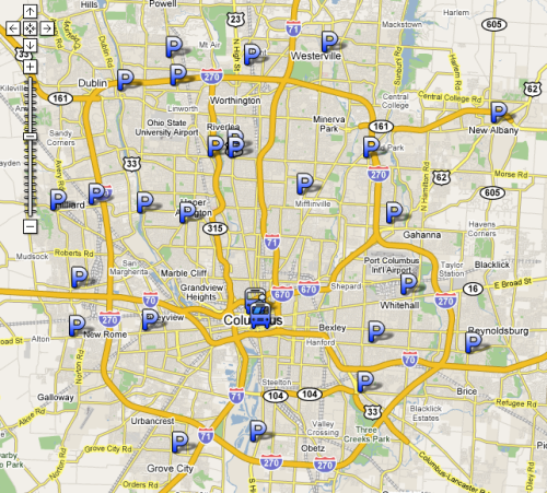
For anyone who doesn’t live within walking distance, or maybe even biking distance, of a bus stop, I’ve tried to make finding a park and ride lot easier for you. COTA has park and ride locations shown on its system map, but we all know Google, with its satellite images and zoomability, is just more fun. Click here to open a new window with a map similar to this:
View Map
Once you’re looking at the map, you can click on the individual “P” icons to see an info window. Each info window contains hyperlinks to COTA maps and schedules for routes serving the stop. Click “Save to My Maps” at the top of the left frame if you want to return to the map later.
If you think that’s fun and you’re up for some more cartography, I created another map with places that I would like to add park and rides, mostly large existing parking lots at strip malls that never fill all of their spaces except for the day after Thanksgiving. Some of my proposed park and rides aren’t near any existing COTA routes, but it’s fun to dream about expansion.